Blank physical map of Europe
The rivers and mountain ranges of Europe, ready to print on A4, Letter, A3 or Tabloid, or to download as PNG and SVG: blank, numbered or labeled. Free, no sign-up.
By the All Map Tools Team
Preview · A4 portrait · Numbered and lettered
Set up your sheet
Version
Paper size
Orientation
Title on the sheet
The PDF comes out at actual size, with margins so nothing gets cut off. In the print window, choose “Save as PDF”. Letter and Tabloid are US paper sizes; A4 and A3, the rest of the world’s.
License
Free for class and personal use
Print it, copy it and hand it out. If you publish it, credit it like this. For other uses, get in touch.
All Map Tools · data Natural Earth, Wikidata
The mountain ranges
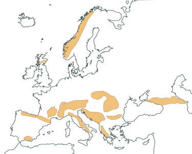
The map shows 14 mountain ranges. The highest is the Caucasus Mountains, topped by Mount Elbrus (5,642 m / 18,510 ft), followed by the Alps (Mont Blanc (4,806 m / 15,768 ft)).
Each range’s highest peak is marked with a triangle; the labeled version adds its name and elevation: Mount Elbrus (5,642 m), Mont Blanc (4,806 m), Mulhacén (3,479 m), Aneto (3,404 m), Corno Grande (2,912 m), and Jezercë (2,694 m) and 8 more.
The rivers
The map shows 22 rivers. The longest is the Volga, at 3,530 km / 2,193 mi, followed by the Danube (2,850 km / 1,771 mi).
How the map is made
Rivers come from Natural Earth (public domain). Lengths are each river’s Wikidata figure: they vary a lot between sources, depending on where the source is placed and how meanders are measured.
Mountain ranges are Natural Earth geographic regions (public domain); each one’s highest peak and its elevation come from Wikidata.
River key (numbers)
Numbers follow alphabetical order. Each length is from that river’s source.
| No. | River | Length | Flows into |
|---|---|---|---|
| 1 | Danube | 2,850 km / 1,771 mi | the Black Sea |
| 2 | Daugava | 1,020 km / 634 mi | the Gulf of Riga |
| 3 | Dnieper | 2,285 km / 1,420 mi | the Dnieper Estuary |
| 4 | Dniester | 1,352 km / 840 mi | the Dniester Lyman |
| 5 | Don | 1,870 km / 1,162 mi | the Sea of Azov |
| 6 | Douro | 947 km / 589 mi | the Atlantic Ocean |
| 7 | Ebro | 953 km / 592 mi | the Mediterranean Sea |
| 8 | Elbe | 1,094 km / 680 mi | the North Sea |
| 9 | Garonne | 647 km / 402 mi | the Gironde estuary |
| 10 | Guadalquivir | 655 km / 407 mi | the Gulf of Cádiz |
| 11 | Guadiana | 856 km / 532 mi | the Gulf of Cádiz |
| 12 | Loire | 1,006 km / 625 mi | the Bay of Biscay |
| 13 | Northern Dvina | 744 km / 462 mi | the Dvina Bay |
| 14 | Oder | 854 km / 531 mi | the Baltic Sea |
| 15 | Po | 652 km / 405 mi | the Adriatic Sea |
| 16 | Rhine | 1,233 km / 766 mi | the North Sea |
| 17 | Rhône | 812 km / 505 mi | the Mediterranean Sea |
| 18 | Seine | 777 km / 483 mi | the English Channel |
| 19 | Tagus | 1,113 km / 691 mi | the Atlantic Ocean |
| 20 | Thames | 334 km / 208 mi | the North Sea |
| 21 | Vistula | 1,047 km / 651 mi | the Gdańsk Bay |
| 22 | Volga | 3,530 km / 2,193 mi | the Caspian Sea |
Mountain range key (letters)
Mountain ranges carry a letter, in alphabetical order, with their highest peak.
| Letter | Mountain range | Highest peak | Elevation |
|---|---|---|---|
| A | Alps | Mont Blanc | 4,806 m / 15,768 ft |
| B | Apennines | Corno Grande | 2,912 m / 9,554 ft |
| C | Balkan Mountains | Botev Peak | 2,376 m / 7,795 ft |
| D | Cantabrian Mountains | Torre Cerredo | 2,649 m / 8,691 ft |
| E | Carpathians | Gerlachovský štít | 2,655 m / 8,711 ft |
| F | Caucasus Mountains | Mount Elbrus | 5,642 m / 18,510 ft |
| G | Dinaric Alps | Jezercë | 2,694 m / 8,839 ft |
| H | Grampian Mountains | Ben Nevis | 1,345 m / 4,413 ft |
| I | Jura Mountains | Crêt de la Neige | 1,718 m / 5,636 ft |
| J | Massif Central | Puy de Sancy | 1,885 m / 6,184 ft |
| K | Pindus Mountains | Smolikas | 2,637 m / 8,652 ft |
| L | Pyrenees | Aneto | 3,404 m / 11,168 ft |
| M | Scandinavian Mountains | Galdhøpiggen | 2,469 m / 8,100 ft |
| N | Sierra Nevada | Mulhacén | 3,479 m / 11,414 ft |
More blank maps
All blank maps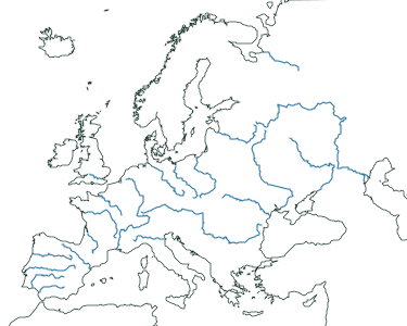
Frequently asked questions
What is the longest river in Europe?
Of those on this map, the Volga, at 3,530 km / 2,193 mi (Wikidata Q626). Next comes the Danube, at 2,850 km / 1,771 mi. Figures vary between sources.
What is the highest mountain range in Europe?
Of those on this map, the Caucasus Mountains, topped by Mount Elbrus (5,642 m / 18,510 ft).
Which mountain ranges are on this map?
Alps, Apennines, Balkan Mountains, Cantabrian Mountains, Carpathians, Caucasus Mountains, Dinaric Alps, Grampian Mountains, Jura Mountains, Massif Central, Pindus Mountains, Pyrenees, Scandinavian Mountains, and Sierra Nevada.
Can I use it in class?
Yes, it’s free. Print it, copy it and hand it out as many times as you like. If you post it on a blog or a class website, credit “All Map Tools · data Natural Earth, Wikidata”.
What order are the numbers and letters in?
Alphabetical: rivers get numbers and mountain ranges get letters. The key is in the tables on this page.
Sources
- River courses: Natural Earth, 1:10m, rivers + lake centerlines (public domain)
- Lengths: Wikidata (CC0), “length” property (P2043) of each river, retrieved 2026-10-31
- Mountain ranges: Natural Earth, 1:10m, geography regions (public domain)
- Highest peak and elevation: Wikidata (CC0), “highest point” (P610) and “elevation above sea level” (P2044), retrieved 2026-10-31
- Countries: Natural Earth, 1:10m (public domain)